
railway-international.com
05
'25
Written on Modified on
Systra's Innovative LiDAR Classification for High-Voltage Power Lines
In one of our latest projects, Systra was tasked with collecting and processing LiDAR and photo data for high-voltage power lines in Europe—a project that demanded unprecedented precision and innovation.
www.systra.com
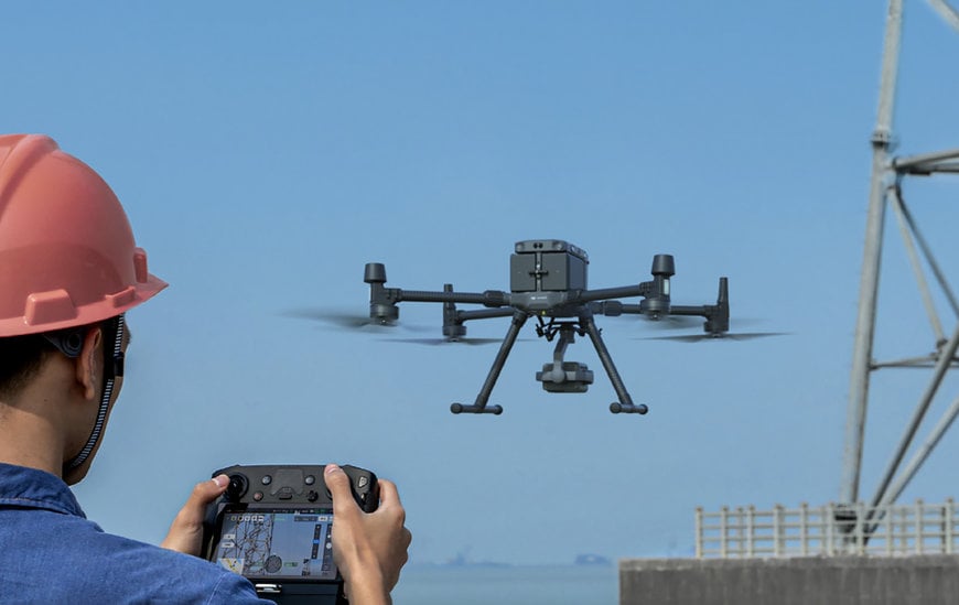
At SYSTRA Canada, we thrive in solving complex challenges with cutting-edge technology.
Unparalleled precision
In one of our latest projects, we were tasked with collecting and processing LiDAR and photo data for high-voltage power lines in Europe—a project that demanded unprecedented precision and innovation.
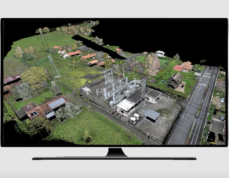
To ensure the highest level of accuracy, drone-collected LiDAR and photos were supported by ground control points meticulously established using GPS. Leveraging SiteScan, a cloud-based software, we generated orthophotos and 3D meshes, providing a solid foundation for detailed analysis.
Our team then pushed boundaries by using GIS software and Python programming to integrate AI capabilities for LiDAR classification. This was no ordinary classification—our approach was entirely customized, offering a level of detail far beyond standard practices.
"With drones, GIS, and AI-powered technology, SYSTRA Canada delivered unprecedented LiDAR classification solutions for high-voltage power lines in Europe. Our innovative approach, combining advanced GIS tools, SiteScan, PLS-CADD, and custom methodologies, reflects our commitment to precision and groundbreaking geospatial solutions for infrastructure management," says Reza Saremi, Geomatics Lead, Transit at SYSTRA Canada.
Innovative in-house tools
To complete the project, we utilized PLS-CADD software to create precise plan and profile drawings, ensuring the data met the needs of our client and exceeded expectations.
This project showcases our expertise in combining advanced technology, AI, and geospatial analysis to deliver groundbreaking solutions.
www.systra.com